 vesseltracker.com
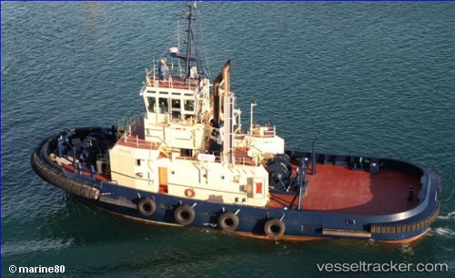
 Tingari
Current Status
Where is the vessel?
Tingari is currently in Near Melbourne, based on AIS data received about 12d ago.
Latest AIS update:
Current position: 37.82000° S, 144.92009° E (Near Melbourne)
Average speed (last 7 days): Loading…
Average speed (last 30 days): Loading…
Vessel profile: Tingari is a Tug with dimensions 32m x 11m.
This page combines live AIS, route history, probable destination signals, nearby traffic, and port activity for practical vessel monitoring.
The current position of vessel Tingari is -37.82000 lat / 144.92009 lng. Updated: 2026-04-09 09:56:12 UTCNearest reference points:
- Near Spotswood
- Near Drysdale
- Near QUEENSCLIFF
Currently sailing under the flag of Australia ![]()
Tingari built in 2000 year
Deadweight:
336 tDetails:
Live Vessel Tingari Analytics (details, animations, etc.)
Recent AIS points (UTC):
2026-04-09 07:33:11 UTC · -37.81997, 144.92009 · SOG 0 kn · COG -1°2026-04-09 09:45:09 UTC · -37.81998, 144.92009 · SOG 0 kn · COG -1°
2026-04-09 09:56:12 UTC · -37.82000, 144.92009 · SOG 0 kn · COG -1°
2026-04-09 09:56:12 UTC · -37.82000, 144.92009 · SOG 0 kn · COG -1°