 vesseltracker.com
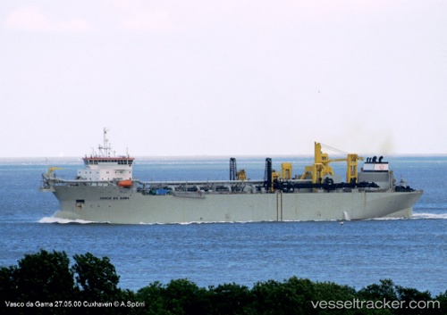
 Vasco Da Gama
Current Status
Where is the vessel?
Vasco Da Gama is currently in Near BATU AMPAR, based on AIS data received less than 1h ago.
Latest AIS update:
Current position: 1.18167° N, 103.98333° E (Near BATU AMPAR)
Average speed (last 7 days): Loading…
Average speed (last 30 days): Loading…
Vessel profile: Vasco Da Gama is a Hopper Dredger with dimensions 207m x 36m.
This page combines live AIS, route history, probable destination signals, nearby traffic, and port activity for practical vessel monitoring.
The current position of vessel Vasco Da Gama is 1.18167 lat / 103.98333 lng. Updated: 2026-05-15 08:21:28 UTCNearest reference points:
- Near BATU AMPAR
- Near Sambu
- Near Changi
Currently sailing under the flag of Belgium ![]()
Vasco Da Gama built in 2000 year
Deadweight:
59235 tDetails:
Live Vessel Vasco Da Gama Analytics (details, animations, etc.)
Recent AIS points (UTC):
2026-05-15 04:32:27 UTC · 1.18151, 103.98382 · SOG 0.1 kn · COG 232°2026-05-15 06:08:28 UTC · 1.18199, 103.98376 · SOG 0 kn · COG 251°
2026-05-15 08:02:27 UTC · 1.18182, 103.98370 · SOG 0.1 kn · COG 236°
2026-05-15 08:21:28 UTC · 1.18167, 103.98333 · SOG 0 kn · COG -1°