 vesseltracker.com
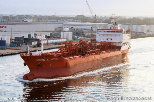
 AKRA 103
Current Status
Where is the vessel?
AKRA 103 is currently in 102 nm NE of TANJUNG JATI, based on AIS data received about 2d ago.
Latest AIS update:
Current position: 4.89379° S, 111.44131° E (102 nm NE of TANJUNG JATI)
Average speed (last 7 days): Loading…
Average speed (last 30 days): Loading…
Vessel profile: AKRA 103 is a Oil/Chemical Tanker with dimensions m x m.
This page combines live AIS, route history, probable destination signals, nearby traffic, and port activity for practical vessel monitoring.
The current position of vessel AKRA 103 is -4.89379 lat / 111.44131 lng. Updated: 2026-05-12 11:52:55 UTCNearest reference points:
- 68 nm NW of Gagak Rimang Fso
- 49 nm NE of TANJUNG JATI
- 60 nm NW of Camar Marine Terminal
Currently sailing under the flag of Indonesia ![]()
Details:
Live Vessel AKRA 103 Analytics (details, animations, etc.)
Recent AIS points (UTC):
2026-05-12 11:52:55 UTC · -4.89379, 111.44131 · SOG 9.9 kn · COG 312°2026-05-12 11:52:55 UTC · -4.89379, 111.44131 · SOG 9.9 kn · COG 312°
2026-05-12 11:52:55 UTC · -4.89379, 111.44131 · SOG 9.9 kn · COG 312°
2026-05-12 11:52:55 UTC · -4.89379, 111.44131 · SOG 9.9 kn · COG 312°