 vesseltracker.com
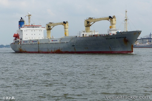
Atlantic Acanthus
Current StatusWhere is the vessel?
Atlantic Acanthus is currently in Near AL DUQM, based on AIS data received less than 1h ago.
Latest AIS update:
Current position: 19.66714° N, 57.72413° E (Near AL DUQM)
Average speed (last 7 days): Loading…
Average speed (last 30 days): Loading…
Vessel profile: Atlantic Acanthus is a Refrigerated Cargo Ship with dimensions 22m x 144m.
This page combines live AIS, route history, probable destination signals, nearby traffic, and port activity for practical vessel monitoring.
The current position of vessel Atlantic Acanthus is 19.66714 lat / 57.72413 lng. Updated: 2026-05-16 12:59:20 UTCNearest reference points:
- Near AL DUQM
- Near Duqm
- 39 nm SE of Pizhou
Details:
Live Vessel Atlantic Acanthus Analytics (details, animations, etc.)
Recent AIS points (UTC):
2026-05-16 09:50:19 UTC · 19.66713, 57.72415 · SOG 0 kn · COG 187°2026-05-16 10:29:19 UTC · 19.66712, 57.72412 · SOG 0 kn · COG 186°
2026-05-16 12:11:19 UTC · 19.66714, 57.72413 · SOG 0 kn · COG 186°
2026-05-16 12:59:20 UTC · 19.66714, 57.72413 · SOG 0 kn · COG 186°