 vesseltracker.com
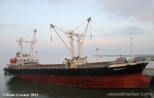
 DANUBE 1
Current Status
Where is the vessel?
DANUBE 1 is currently in 208 nm NW of Porto Grande, based on AIS data received about 1h ago.
Latest AIS update:
Current position: 19.17429° N, 27.73810° W (208 nm NW of Porto Grande)
Average speed (last 7 days): Loading…
Average speed (last 30 days): Loading…
Vessel profile: DANUBE 1 is a General Cargo with dimensions m x m.
This page combines live AIS, route history, probable destination signals, nearby traffic, and port activity for practical vessel monitoring.
The current position of vessel DANUBE 1 is 19.17429 lat / -27.73810 lng. Updated: 2026-04-24 13:41:00 UTCNearest reference points:
- 138 nm N of Porto Grande
- Open sea, approx. 407 nm off the nearest listed port
Currently sailing under the flag of Saint Kitts and Nevis ![]()
Details:
Live Vessel DANUBE 1 Analytics (details, animations, etc.)
Recent AIS points (UTC):
2026-04-24 10:06:16 UTC · 19.59676, -27.18109 · SOG 11 kn · COG 230°2026-04-24 11:56:05 UTC · 19.38407, -27.46707 · SOG 11.2 kn · COG 230°
2026-04-24 13:33:14 UTC · 19.18970, -27.71807 · SOG 11.1 kn · COG 230°
2026-04-24 13:41:00 UTC · 19.17429, -27.73810 · SOG 11.5 kn · COG 230°