 vesseltracker.com
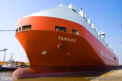
 Tarago
Current Status
Where is the vessel?
Tarago is currently in 94 nm SW of BYAH, based on AIS data received less than 1h ago.
Latest AIS update:
Current position: 8.38667° S, 105.60500° E (94 nm SW of BYAH)
Average speed (last 7 days): Loading…
Average speed (last 30 days): Loading…
Vessel profile: Tarago is a Vehicles Carrier with dimensions 245m x 32m.
This page combines live AIS, route history, probable destination signals, nearby traffic, and port activity for practical vessel monitoring.
The current position of vessel Tarago is -8.38667 lat / 105.60500 lng. Updated: 2026-05-14 22:29:59 UTCNearest reference points:
- Near Cigading
- Near CIWANDAN
- Near MERAK
Currently sailing under the flag of Norway ![]()
Tarago built in 2000 year
Deadweight:
39516 tDetails:
Live Vessel Tarago Analytics (details, animations, etc.)
Recent AIS points (UTC):
2026-05-14 19:14:59 UTC · -9.18167, 105.89500 · SOG 15 kn · COG -1°2026-05-14 20:08:56 UTC · -8.96167, 105.81500 · SOG 15 kn · COG -1°
2026-05-14 22:06:00 UTC · -8.48333, 105.64333 · SOG 15 kn · COG -1°
2026-05-14 22:29:59 UTC · -8.38667, 105.60500 · SOG 15 kn · COG -1°