 vesseltracker.com
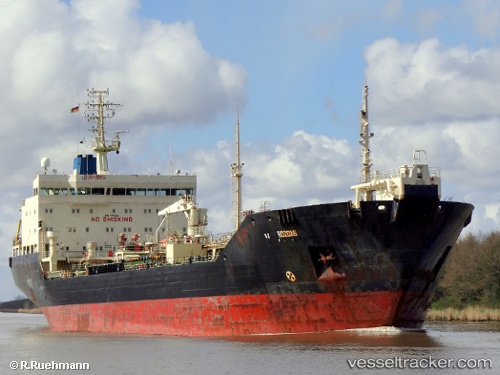
 ANABAR
Current Status
Where is the vessel?
ANABAR is currently in 96 nm NW of Dudinka, based on AIS data received less than 1h ago.
Latest AIS update:
Current position: 70.72667° N, 83.56500° E (96 nm NW of Dudinka)
Average speed (last 7 days): Loading…
Average speed (last 30 days): Loading…
Vessel profile: ANABAR is a Oil Products Tanker with dimensions 158m x 25m.
This page combines live AIS, route history, probable destination signals, nearby traffic, and port activity for practical vessel monitoring.
The current position of vessel ANABAR is 70.72667 lat / 83.56500 lng. Updated: 2026-05-14 21:36:30 UTCNearest reference points:
- 103 nm NW of Dudinka
Currently sailing under the flag of Russia ![]()
ANABAR built in 2002 year
Deadweight:
19800 tDetails:
Live Vessel ANABAR Analytics (details, animations, etc.)
Recent AIS points (UTC):
2026-05-14 13:46:34 UTC · 70.72701, 83.56427 · SOG 0 kn · COG 354°2026-05-14 13:46:34 UTC · 70.72701, 83.56427 · SOG 0 kn · COG 354°
2026-05-14 13:46:34 UTC · 70.72701, 83.56427 · SOG 0 kn · COG 354°
2026-05-14 21:36:30 UTC · 70.72667, 83.56500 · SOG 0 kn · COG -1°