 vesseltracker.com
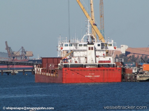
Kiunga Chief
Current StatusWhere is the vessel?
Kiunga Chief is currently in 18 nm NE of Kapal, based on AIS data received about 2h ago.
Latest AIS update:
Current position: 8.36837° S, 142.99026° E (18 nm NE of Kapal)
Average speed (last 7 days): Loading…
Average speed (last 30 days): Loading…
Vessel profile: Kiunga Chief is a General Cargo Ship with dimensions 22m x 89m.
This page combines live AIS, route history, probable destination signals, nearby traffic, and port activity for practical vessel monitoring.
The current position of vessel Kiunga Chief is -8.36837 lat / 142.99026 lng. Updated: 2026-05-01 01:04:48 UTCNearest reference points:
- 46 nm NW of Kopi
- Near Manda
- Near Thursday Island
Details:
Live Vessel Kiunga Chief Analytics (details, animations, etc.)
Recent AIS points (UTC):
2026-04-30 22:21:25 UTC · -8.35167, 142.88333 · SOG 1 kn · COG -1°2026-05-01 00:04:08 UTC · -8.35345, 142.91832 · SOG 4.3 kn · COG 84°
2026-05-01 00:57:28 UTC · -8.36500, 142.98167 · SOG 3 kn · COG -1°
2026-05-01 01:04:48 UTC · -8.36837, 142.99026 · SOG 3.7 kn · COG 103°