 vesseltracker.com
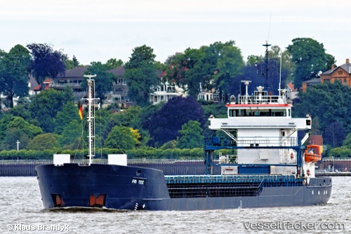
 Fri Tide
Current Status
Where is the vessel?
Fri Tide is currently in 67 nm S of San Clodio, based on AIS data received about 1h ago.
Latest AIS update:
Current position: 47.38103° N, 6.95411° W (67 nm S of San Clodio)
Average speed (last 7 days): Loading…
Average speed (last 30 days): Loading…
Vessel profile: Fri Tide is a General Cargo Ship with dimensions 89m x 12m.
This page combines live AIS, route history, probable destination signals, nearby traffic, and port activity for practical vessel monitoring.
The current position of vessel Fri Tide is 47.38103 lat / -6.95411 lng. Updated: 2026-05-16 07:49:10 UTCNearest reference points:
- 60 nm SE of San Clodio
- 58 nm SE of Rietheim-Weilheim
- 46 nm W of SEIN
Currently sailing under the flag of Bahamas ![]()
Fri Tide built in 2000 year
Deadweight:
3400 tDetails:
Live Vessel Fri Tide Analytics (details, animations, etc.)
Recent AIS points (UTC):
2026-05-16 05:05:39 UTC · 47.77833, -6.63667 · SOG 9 kn · COG -1°2026-05-16 05:44:38 UTC · 47.68333, -6.70833 · SOG 9 kn · COG -1°
2026-05-16 07:15:40 UTC · 47.45961, -6.90127 · SOG 9.7 kn · COG 205°
2026-05-16 07:49:10 UTC · 47.38103, -6.95411 · SOG 9.3 kn · COG 207°