 vesseltracker.com
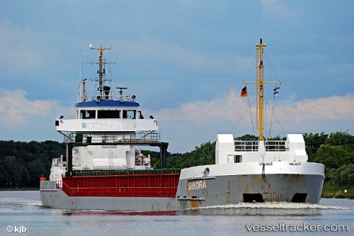
 Ventura
Current Status
Where is the vessel?
Ventura is currently in Near Grimsby, based on AIS data received less than 1h ago.
Latest AIS update:
Current position: 53.57743° N, 0.07386° W (Near Grimsby)
Average speed (last 7 days): Loading…
Average speed (last 30 days): Loading…
Vessel profile: Ventura is a Multi Purpose Carrier with dimensions 88m x 12m.
This page combines live AIS, route history, probable destination signals, nearby traffic, and port activity for practical vessel monitoring.
The current position of vessel Ventura is 53.57743 lat / -0.07386 lng. Updated: 2026-05-16 12:09:35 UTCNearest reference points:
- Near Grimsby
- Near Immingham
- Near Hull
Currently sailing under the flag of United Kingdom ![]()
Ventura built in 2000 year
Deadweight:
3850 tDetails:
Live Vessel Ventura Analytics (details, animations, etc.)
Recent AIS points (UTC):
2026-05-16 07:46:28 UTC · 53.57751, -0.07398 · SOG 0 kn · COG 207°2026-05-16 10:04:25 UTC · 53.57740, -0.07378 · SOG 0 kn · COG 207°
2026-05-16 10:07:21 UTC · 53.57744, -0.07384 · SOG 0 kn · COG 207°
2026-05-16 12:09:35 UTC · 53.57743, -0.07386 · SOG 0 kn · COG 207°