 vesseltracker.com
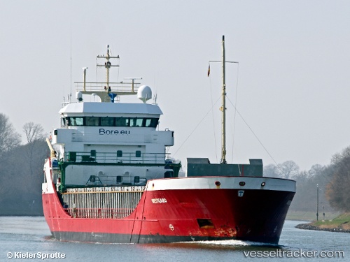
 Westborg
Current Status
Where is the vessel?
Westborg is currently in Near Muuga, based on AIS data received less than 1h ago.
Latest AIS update:
Current position: 59.51179° N, 24.95844° E (Near Muuga)
Average speed (last 7 days): Loading…
Average speed (last 30 days): Loading…
Vessel profile: Westborg is a Multi Purpose Carrier with dimensions 89m x 12m.
This page combines live AIS, route history, probable destination signals, nearby traffic, and port activity for practical vessel monitoring.
The current position of vessel Westborg is 59.51179 lat / 24.95844 lng. Updated: 2026-05-16 05:45:41 UTCNearest reference points:
- Near Mölgi
- Near Vanasadam
- Near Nurme
Currently sailing under the flag of Netherlands ![]()
Westborg built in 2000 year
Deadweight:
3780 tDetails:
Live Vessel Westborg Analytics (details, animations, etc.)
Recent AIS points (UTC):
2026-05-16 02:05:53 UTC · 59.65813, 23.96083 · SOG 9.1 kn · COG 93°2026-05-16 03:37:00 UTC · 59.64165, 24.41616 · SOG 8.9 kn · COG 96°
2026-05-16 04:14:00 UTC · 59.63145, 24.59461 · SOG 8.5 kn · COG 97°
2026-05-16 05:45:41 UTC · 59.51179, 24.95844 · SOG 7.8 kn · COG 169°