 vesseltracker.com
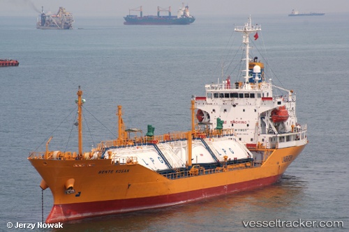
 GAS KUMAI
Current Status
Where is the vessel?
GAS KUMAI is currently in 73 nm E of Kumai, based on AIS data received about 3h ago.
Latest AIS update:
Current position: 2.72098° S, 112.93486° E (73 nm E of Kumai)
Average speed (last 7 days): Loading…
Average speed (last 30 days): Loading…
Vessel profile: GAS KUMAI is a Lpg Tanker with dimensions m x m.
This page combines live AIS, route history, probable destination signals, nearby traffic, and port activity for practical vessel monitoring.
The current position of vessel GAS KUMAI is -2.72098 lat / 112.93486 lng. Updated: 2026-05-14 23:42:58 UTCNearest reference points:
- 86 nm W of Taboneo
- Near BANJARMASIN
- Near Taboneo
Currently sailing under the flag of Indonesia ![]()
Details:
Live Vessel GAS KUMAI Analytics (details, animations, etc.)
Recent AIS points (UTC):
2026-05-14 20:15:58 UTC · -2.72090, 112.93491 · SOG 0.1 kn · COG -1°2026-05-14 22:12:58 UTC · -2.72064, 112.93473 · SOG 0 kn · COG -1°
2026-05-14 22:27:58 UTC · -2.72074, 112.93479 · SOG 0 kn · COG -1°
2026-05-14 23:42:58 UTC · -2.72098, 112.93486 · SOG 0.1 kn · COG -1°