 vesseltracker.com
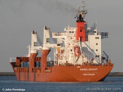
 Singelgracht
Current Status
Where is the vessel?
Singelgracht is currently in Near Meads Bay Beach, based on AIS data received less than 1h ago.
Latest AIS update:
Current position: 18.15400° N, 63.13417° W (Near Meads Bay Beach)
Average speed (last 7 days): Loading…
Average speed (last 30 days): Loading…
Vessel profile: Singelgracht is a General Cargo Ship with dimensions 169m x 24m.
This page combines live AIS, route history, probable destination signals, nearby traffic, and port activity for practical vessel monitoring.
The current position of vessel Singelgracht is 18.15400 lat / -63.13417 lng. Updated: 2026-05-02 16:25:20 UTCNearest reference points:
- Near ST MAARTEN
- Near GUSTAVIA
- Near Spanish Town
Currently sailing under the flag of Netherlands ![]()
Singelgracht built in 2000 year
Deadweight:
21402 tDetails:
Live Vessel Singelgracht Analytics (details, animations, etc.)
Recent AIS points (UTC):
2026-05-02 13:06:38 UTC · 18.15821, -63.10896 · SOG 0 kn · COG 99°2026-05-02 14:03:38 UTC · 18.15695, -63.10903 · SOG 0.2 kn · COG 77°
2026-05-02 15:34:12 UTC · 18.15342, -63.13418 · SOG 0.1 kn · COG 74°
2026-05-02 16:25:20 UTC · 18.15400, -63.13417 · SOG 0.2 kn · COG -1°