 vesseltracker.com
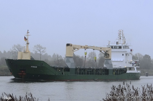
 Agena
Agena
Current Status
Where is the vessel?
Agena is currently in Near Las Palmas, based on AIS data received less than 1h ago.
Latest AIS update:
Current position: 28.12668° N, 15.40480° W (Near Las Palmas)
Average speed (last 7 days): Loading…
Average speed (last 30 days): Loading…
Vessel profile: Agena is a Multi Purpose Carrier with dimensions 86m x 13m.
This page combines live AIS, route history, probable destination signals, nearby traffic, and port activity for practical vessel monitoring.
The current position of vessel Agena is 28.12668 lat / -15.40480 lng. Updated: 2026-05-13 12:04:55 UTCNearest reference points:
- Near Las Palmas
- Near Las Palmas de Gran Canaria
- Near TALIARTE
Currently sailing under the flag of Antigua Barbuda ![]()
Agena built in 2001 year
Deadweight:
3414 tDetails:
Live Vessel Agena Analytics (details, animations, etc.)
Recent AIS points (UTC):
2026-05-13 06:13:36 UTC · 28.09345, -15.40301 · SOG 0.9 kn · COG 107°2026-05-13 10:22:56 UTC · 28.12669, -15.40483 · SOG 0 kn · COG 183°
2026-05-13 10:43:52 UTC · 28.12669, -15.40480 · SOG 0 kn · COG 182°
2026-05-13 12:04:55 UTC · 28.12668, -15.40480 · SOG 0 kn · COG 182°