 vesseltracker.com
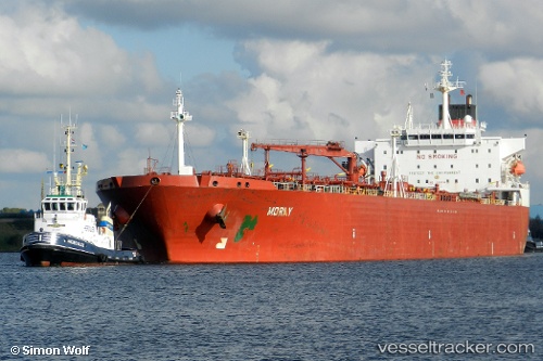
 BORAY
BORAY
Current Status
Where is the vessel?
BORAY is currently in 22 nm S of Taman', based on AIS data received about 114d ago.
Latest AIS update:
Current position: 44.86601° N, 36.59067° E (22 nm S of Taman')
Average speed (last 7 days): Loading…
Average speed (last 30 days): Loading…
Vessel profile: BORAY is a Chemical/Oil Products Tanker with dimensions 32m x 228m.
This page combines live AIS, route history, probable destination signals, nearby traffic, and port activity for practical vessel monitoring.
The current position of vessel BORAY is 44.86601 lat / 36.59067 lng. Updated: 2026-01-21 07:56:00 UTCNearest reference points:
- 21 nm S of Taman'
- 17 nm S of Taman'
- 17 nm SW of Taman'
Currently sailing under the flag of Russia ![]()
BORAY built in 2000 year
Deadweight:
74999 tDetails:
Live Vessel BORAY Analytics (details, animations, etc.)
Recent AIS points (UTC):
2026-01-21 07:56:00 UTC · 44.86601, 36.59067 · SOG 0.1 kn · COG 321°