 vesseltracker.com
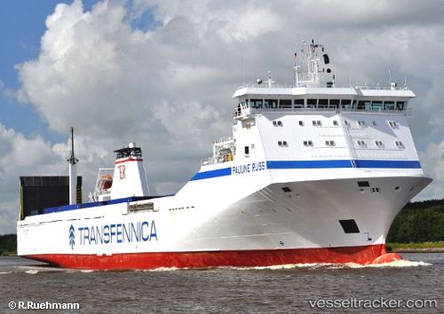
Pauline Russ
Current StatusWhere is the vessel?
Pauline Russ is currently in Near Mostaganem, based on AIS data received about 2h ago.
Latest AIS update:
Current position: 35.93382° N, 0.06095° E (Near Mostaganem)
Average speed (last 7 days): Loading…
Average speed (last 30 days): Loading…
Vessel profile: Pauline Russ is a Ro Ro Cargo Ship with dimensions 18m x 155m.
This page combines live AIS, route history, probable destination signals, nearby traffic, and port activity for practical vessel monitoring.
The current position of vessel Pauline Russ is 35.93382 lat / 0.06095 lng. Updated: 2026-05-15 05:17:00 UTCNearest reference points:
- Near Mostaganem
- Near Arzew
- Near Oran
Details:
Live Vessel Pauline Russ Analytics (details, animations, etc.)
Recent AIS points (UTC):
2026-05-15 03:11:18 UTC · 36.33677, 0.25876 · SOG 11.4 kn · COG 210°2026-05-15 04:59:03 UTC · 35.99274, 0.05088 · SOG 15.7 kn · COG 185°
2026-05-15 05:17:00 UTC · 35.93382, 0.06095 · SOG 6.8 kn · COG 142°
2026-05-15 05:17:00 UTC · 35.93382, 0.06095 · SOG 6.8 kn · COG 142°