 vesseltracker.com
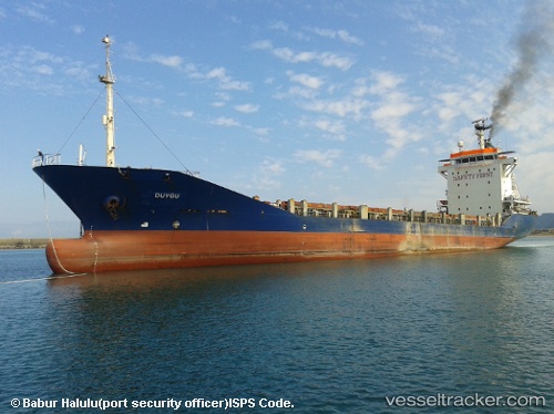
 DUYGU
DUYGU
Current Status
Where is the vessel?
DUYGU is currently in Near SLUISKIL, based on AIS data received about 5h ago.
Latest AIS update:
Current position: 51.27490° N, 3.83776° E (Near SLUISKIL)
Average speed (last 7 days): Loading…
Average speed (last 30 days): Loading…
Vessel profile: DUYGU is a Container Ship with dimensions 112m x 18m.
This page combines live AIS, route history, probable destination signals, nearby traffic, and port activity for practical vessel monitoring.
The current position of vessel DUYGU is 51.27490 lat / 3.83776 lng. Updated: 2026-05-17 10:57:23 UTCNearest reference points:
- Near SLUISKIL
- Near Terneuzen
- Near Baarland
Currently sailing under the flag of Vanuatu ![]()
DUYGU built in 2000 year
Deadweight:
6273 tDetails:
Live Vessel DUYGU Analytics (details, animations, etc.)
Recent AIS points (UTC):
2026-05-17 10:57:23 UTC · 51.27490, 3.83776 · SOG 0 kn · COG 198°2026-05-17 10:57:23 UTC · 51.27490, 3.83776 · SOG 0 kn · COG 198°
2026-05-17 10:57:23 UTC · 51.27490, 3.83776 · SOG 0 kn · COG 198°
2026-05-17 10:57:23 UTC · 51.27490, 3.83776 · SOG 0 kn · COG 198°