 vesseltracker.com
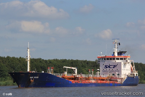
 ARRIBA
Current Status
Where is the vessel?
ARRIBA is currently in Near SHINAS, based on AIS data received less than 1h ago.
Latest AIS update:
Current position: 24.69452° N, 56.62014° E (Near SHINAS)
Average speed (last 7 days): Loading…
Average speed (last 30 days): Loading…
Vessel profile: ARRIBA is a Oil/Chemical Tanker with dimensions m x m.
This page combines live AIS, route history, probable destination signals, nearby traffic, and port activity for practical vessel monitoring.
The current position of vessel ARRIBA is 24.69452 lat / 56.62014 lng. Updated: 2026-04-23 12:04:56 UTCNearest reference points:
- 18 nm SE of SHINAS
- 17 nm SE of Shinas
- Near Fujairah
Currently sailing under the flag of Palau ![]()
Details:
Live Vessel ARRIBA Analytics (details, animations, etc.)
Recent AIS points (UTC):
2026-04-23 07:59:35 UTC · 25.08983, 56.85283 · SOG 3.2 kn · COG 251°2026-04-23 09:23:19 UTC · 24.92777, 56.75851 · SOG 10 kn · COG 203°
2026-04-23 10:37:41 UTC · 24.74096, 56.65763 · SOG 9.8 kn · COG 200°
2026-04-23 12:04:56 UTC · 24.69452, 56.62014 · SOG 0 kn · COG 354°