 vesseltracker.com
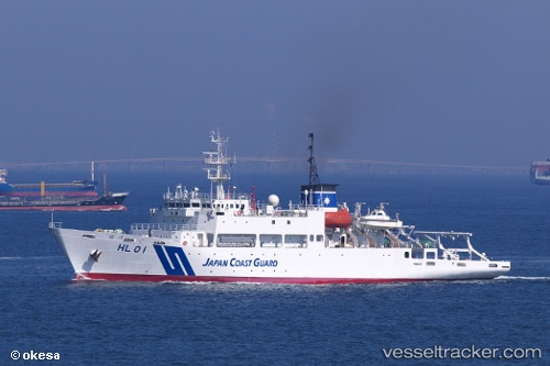
Shoyo
Current StatusWhere is the vessel?
Shoyo is currently in Near Urayasu, based on AIS data received less than 1h ago.
Latest AIS update:
Current position: 35.58456° N, 139.92493° E (Near Urayasu)
Average speed (last 7 days): Loading…
Average speed (last 30 days): Loading…
Vessel profile: Shoyo is a Research Vessel with dimensions 16m x 98m.
This page combines live AIS, route history, probable destination signals, nearby traffic, and port activity for practical vessel monitoring.
The current position of vessel Shoyo is 35.58456 lat / 139.92493 lng. Updated: 2026-05-15 00:15:15 UTCNearest reference points:
- Near ANEGASAKI
- Near Aomi
- Near Kawasaki
Details:
Live Vessel Shoyo Analytics (details, animations, etc.)
Recent AIS points (UTC):
2026-05-14 19:54:07 UTC · 35.58434, 139.92503 · SOG 0 kn · COG 22°2026-05-14 21:24:10 UTC · 35.58437, 139.92500 · SOG 0 kn · COG 31°
2026-05-14 22:21:12 UTC · 35.58447, 139.92494 · SOG 0 kn · COG 56°
2026-05-15 00:15:15 UTC · 35.58456, 139.92493 · SOG 0 kn · COG 64°