 vesseltracker.com
 LIBERTY KING
Current Status
Where is the vessel?
LIBERTY KING is currently in 22 nm SE of Boseong-gun, based on AIS data received less than 1h ago.
Latest AIS update:
Current position: 34.43466° N, 127.97265° E (22 nm SE of Boseong-gun)
Average speed (last 7 days): Loading…
Average speed (last 30 days): Loading…
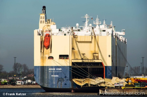
Vessel profile: LIBERTY KING is a Vehicles Carrier with dimensions 32m x 200m.
This page combines live AIS, route history, probable destination signals, nearby traffic, and port activity for practical vessel monitoring.
The current position of vessel LIBERTY KING is 34.43466 lat / 127.97265 lng. Updated: 2026-05-14 12:00:29 UTCNearest reference points:
- 15 nm SE of Boseong-gun
- 13 nm SE of Boseong-gun
- Near Yeosu
Currently sailing under the flag of Marshall Islands ![]()
LIBERTY KING built in 1998 year
Deadweight:
21511 tDetails:
Live Vessel LIBERTY KING Analytics (details, animations, etc.)
Recent AIS points (UTC):
2026-05-14 07:03:29 UTC · 33.90333, 127.66833 · SOG 9 kn · COG -1°2026-05-14 10:19:48 UTC · 34.21943, 127.88374 · SOG 9.2 kn · COG 42°
2026-05-14 11:00:00 UTC · 34.30412, 127.93411 · SOG 8.4 kn · COG 20°
2026-05-14 12:00:29 UTC · 34.43466, 127.97265 · SOG 7.6 kn · COG 19°