 vesseltracker.com
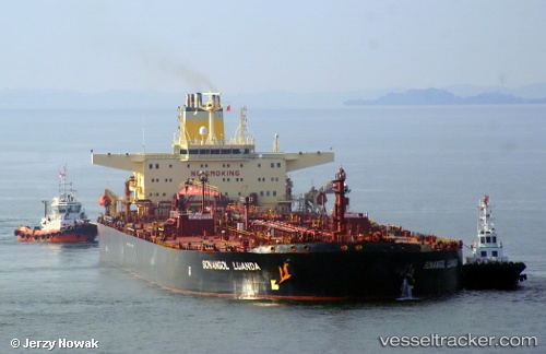
 Sonangol Luanda
Current Status
Where is the vessel?
Sonangol Luanda is currently in 53 nm NE of Kampung Tanjung Langsat, based on AIS data received about 23d ago.
Latest AIS update:
Current position: 2.06505° N, 104.66795° E (53 nm NE of Kampung Tanjung Langsat)
Average speed (last 7 days): Loading…
Average speed (last 30 days): Loading…
Vessel profile: Sonangol Luanda is a Crude Oil Tanker with dimensions 274m x 274m.
This page combines live AIS, route history, probable destination signals, nearby traffic, and port activity for practical vessel monitoring.
The current position of vessel Sonangol Luanda is 2.06505 lat / 104.66795 lng. Updated: 2026-04-22 07:13:36 UTCNearest reference points:
- 53 nm NE of PENGERANG
- 52 nm NE of PENGERANG
- 47 nm NE of PENGERANG
Currently sailing under the flag of Bahamas ![]()
Sonangol Luanda built in 2000 year
Deadweight:
159178 tDetails:
Live Vessel Sonangol Luanda Analytics (details, animations, etc.)
Recent AIS points (UTC):
2026-04-22 07:13:36 UTC · 2.06505, 104.66795 · SOG 0 kn · COG -1°