 vesseltracker.com
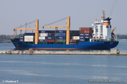
 IONIA
IONIA
Current Status
Where is the vessel?
IONIA is currently in Near PANORMITIS, based on AIS data received about 1h ago.
Latest AIS update:
Current position: 36.48969° N, 27.77400° E (Near PANORMITIS)
Average speed (last 7 days): Loading…
Average speed (last 30 days): Loading…
Vessel profile: IONIA is a Container Ship with dimensions m x m.
This page combines live AIS, route history, probable destination signals, nearby traffic, and port activity for practical vessel monitoring.
The current position of vessel IONIA is 36.48969 lat / 27.77400 lng. Updated: 2026-05-16 01:57:56 UTCNearest reference points:
- Near PANORMITIS
- Near Datça
- Near Symi
Details:
Live Vessel IONIA Analytics (details, animations, etc.)
Recent AIS points (UTC):
2026-05-15 22:11:02 UTC · 36.19855, 28.73701 · SOG 14.3 kn · COG 309°2026-05-16 00:05:08 UTC · 36.46565, 28.27334 · SOG 15.3 kn · COG 301°
2026-05-16 01:34:07 UTC · 36.48353, 27.87336 · SOG 12.5 kn · COG 275°
2026-05-16 01:57:56 UTC · 36.48969, 27.77400 · SOG 12.5 kn · COG 275°