 vesseltracker.com
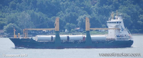
 INDUSTRIAL AIM
Current Status
Where is the vessel?
INDUSTRIAL AIM is currently in 37 nm SE of Yucatan Channel, based on AIS data received about 3h ago.
Latest AIS update:
Current position: 21.29988° N, 84.71805° W (37 nm SE of Yucatan Channel)
Average speed (last 7 days): Loading…
Average speed (last 30 days): Loading…
Vessel profile: INDUSTRIAL AIM is a General Cargo with dimensions 100m x 17m.
This page combines live AIS, route history, probable destination signals, nearby traffic, and port activity for practical vessel monitoring.
The current position of vessel INDUSTRIAL AIM is 21.29988 lat / -84.71805 lng. Updated: 2026-05-14 12:18:04 UTCNearest reference points:
- 58 nm S of San Julian
- Near Puerto Juárez
- Near Mariel
Currently sailing under the flag of Antigua Barbuda ![]()
Details:
Live Vessel INDUSTRIAL AIM Analytics (details, animations, etc.)
Recent AIS points (UTC):
2026-05-14 10:26:11 UTC · 21.15624, -84.37420 · SOG 11.3 kn · COG 291°2026-05-14 10:26:11 UTC · 21.15624, -84.37420 · SOG 11.3 kn · COG 291°
2026-05-14 12:18:04 UTC · 21.29988, -84.71805 · SOG 11.2 kn · COG 295°
2026-05-14 12:18:04 UTC · 21.29988, -84.71805 · SOG 11.2 kn · COG 295°