 vesseltracker.com
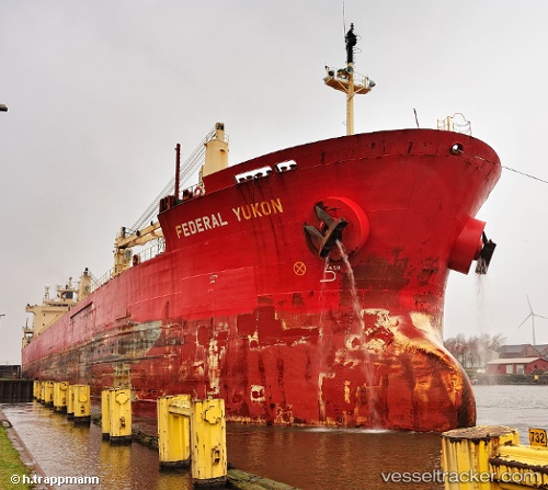
 Federal Yukon
Current Status
Where is the vessel?
Federal Yukon is currently in Near Tortella, based on AIS data received about 1h ago.
Latest AIS update:
Current position: 42.25929° N, 26.46665° W (Near Tortella)
Average speed (last 7 days): Loading…
Average speed (last 30 days): Loading…
Vessel profile: Federal Yukon is a Bulk Carrier with dimensions 200m x 200m.
This page combines live AIS, route history, probable destination signals, nearby traffic, and port activity for practical vessel monitoring.
The current position of vessel Federal Yukon is 42.25929 lat / -26.46665 lng. Updated: 2026-05-01 19:57:24 UTCNearest reference points:
- 81 nm SW of Matillas
Currently sailing under the flag of Marshall Is ![]()
Federal Yukon built in 2000 year
Deadweight:
36563 tDetails:
Live Vessel Federal Yukon Analytics (details, animations, etc.)
Recent AIS points (UTC):
2026-05-01 16:33:03 UTC · 42.05338, -25.76616 · SOG 10.1 kn · COG 294°2026-05-01 17:21:25 UTC · 42.10579, -25.92830 · SOG 10 kn · COG 296°
2026-05-01 19:12:54 UTC · 42.21344, -26.31441 · SOG 9.6 kn · COG 294°
2026-05-01 19:57:24 UTC · 42.25929, -26.46665 · SOG 9.9 kn · COG 293°