 vesseltracker.com
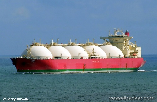
 Sohar Lng
Current Status
Where is the vessel?
Sohar Lng is currently in 105 nm W of Okha, based on AIS data received about 1h ago.
Latest AIS update:
Current position: 22.20642° N, 67.21536° E (105 nm W of Okha)
Average speed (last 7 days): Loading…
Average speed (last 30 days): Loading…
Vessel profile: Sohar Lng is a Lng Tanker with dimensions 298m x 46m.
This page combines live AIS, route history, probable destination signals, nearby traffic, and port activity for practical vessel monitoring.
The current position of vessel Sohar Lng is 22.20642 lat / 67.21536 lng. Updated: 2026-05-15 20:22:13 UTCNearest reference points:
- 84 nm SW of Keti Bandar
- 49 nm S of Positra
- 54 nm S of Positra
Currently sailing under the flag of Panama ![]()
Sohar Lng built in 2001 year
Deadweight:
71997 tDetails:
Live Vessel Sohar Lng Analytics (details, animations, etc.)
Recent AIS points (UTC):
2026-05-15 16:05:31 UTC · 22.22500, 67.18500 · SOG 1 kn · COG -1°2026-05-15 17:56:53 UTC · 22.22733, 67.21900 · SOG 1.1 kn · COG 146°
2026-05-15 19:28:13 UTC · 22.23906, 67.25305 · SOG 1.9 kn · COG 153°
2026-05-15 20:22:13 UTC · 22.20642, 67.21536 · SOG 4.3 kn · COG 242°