 vesseltracker.com
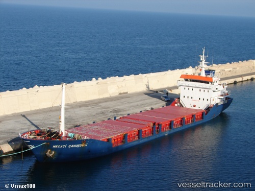
 NECATI CAVUSOGLU
Current Status
Where is the vessel?
NECATI CAVUSOGLU is currently in Near Batumi, based on AIS data received about 1h ago.
Latest AIS update:
Current position: 41.64755° N, 41.65195° E (Near Batumi)
Average speed (last 7 days): Loading…
Average speed (last 30 days): Loading…
Vessel profile: NECATI CAVUSOGLU is a General Cargo Ship with dimensions 88m x 88m.
This page combines live AIS, route history, probable destination signals, nearby traffic, and port activity for practical vessel monitoring.
The current position of vessel NECATI CAVUSOGLU is 41.64755 lat / 41.65195 lng. Updated: 2026-04-06 13:50:07 UTCNearest reference points:
- Near Batumi
- Near Sup'sa
- Near Hopa
Currently sailing under the flag of Barbados ![]()
NECATI CAVUSOGLU built in 1999 year
Deadweight:
3171 tDetails:
Live Vessel NECATI CAVUSOGLU Analytics (details, animations, etc.)
Recent AIS points (UTC):
2026-04-06 08:05:06 UTC · 41.64752, 41.65192 · SOG 0 kn · COG 259°2026-04-06 10:02:07 UTC · 41.64754, 41.65196 · SOG 0 kn · COG 259°
2026-04-06 11:32:07 UTC · 41.64755, 41.65194 · SOG 0 kn · COG 260°
2026-04-06 13:50:07 UTC · 41.64755, 41.65195 · SOG 0 kn · COG 259°