 vesseltracker.com
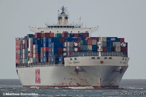
 GSL ARCADIA
Current Status
Where is the vessel?
GSL ARCADIA is currently in Near JINHAI HEAVY INDUSTR, based on AIS data received less than 1h ago.
Latest AIS update:
Current position: 30.26850° N, 122.25695° E (Near JINHAI HEAVY INDUSTR)
Average speed (last 7 days): Loading…
Average speed (last 30 days): Loading…
Vessel profile: GSL ARCADIA is a Container Ship with dimensions 40m x 277m.
This page combines live AIS, route history, probable destination signals, nearby traffic, and port activity for practical vessel monitoring.
The current position of vessel GSL ARCADIA is 30.26850 lat / 122.25695 lng. Updated: 2026-05-15 10:21:16 UTCNearest reference points:
- Near JINHAI HEAVY INDUSTR
- 10 nm NE of JINHAI HEAVY INDUSTR
- 11 nm N of JINHAI HEAVY INDUSTR
Currently sailing under the flag of Liberia ![]()
GSL ARCADIA built in 2000 year
Deadweight:
67580 tDetails:
Live Vessel GSL ARCADIA Analytics (details, animations, etc.)
Recent AIS points (UTC):
2026-05-15 07:06:14 UTC · 30.26848, 122.25696 · SOG 0 kn · COG 213°2026-05-15 07:48:20 UTC · 30.26853, 122.25693 · SOG 0 kn · COG 213°
2026-05-15 09:54:14 UTC · 30.26848, 122.25696 · SOG 0 kn · COG 213°
2026-05-15 10:21:16 UTC · 30.26850, 122.25695 · SOG 0 kn · COG 213°