 vesseltracker.com
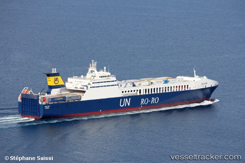
 Gallipoli Seaways
Current Status
Where is the vessel?
Gallipoli Seaways is currently in 22 nm NE of Giovinazzo, based on AIS data received less than 1h ago.
Latest AIS update:
Current position: 41.50769° N, 16.90114° E (22 nm NE of Giovinazzo)
Average speed (last 7 days): Loading…
Average speed (last 30 days): Loading…
Vessel profile: Gallipoli Seaways is a Ro Ro Cargo Ship with dimensions 193m x 26m.
This page combines live AIS, route history, probable destination signals, nearby traffic, and port activity for practical vessel monitoring.
The current position of vessel Gallipoli Seaways is 41.50769 lat / 16.90114 lng. Updated: 2026-05-14 11:37:44 UTCNearest reference points:
- Near Monopoli
- Near Marina di Ginosa
- Near Porto Di Brindisi
Currently sailing under the flag of Turkey ![]()
Gallipoli Seaways built in 2001 year
Deadweight:
9830 tDetails:
Live Vessel Gallipoli Seaways Analytics (details, animations, etc.)
Recent AIS points (UTC):
2026-05-14 08:24:15 UTC · 42.27401, 16.07174 · SOG 18.2 kn · COG 143°2026-05-14 10:12:09 UTC · 41.84127, 16.52420 · SOG 18.5 kn · COG 132°
2026-05-14 10:40:56 UTC · 41.74399, 16.66328 · SOG 18.4 kn · COG 132°
2026-05-14 11:37:44 UTC · 41.50769, 16.90114 · SOG 18.5 kn · COG 147°