 vesseltracker.com
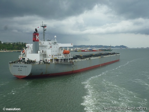
 HOANH SON SUN
Current Status
Where is the vessel?
HOANH SON SUN is currently in 67 nm SE of Preobrazheniye, based on AIS data received about 3h ago.
Latest AIS update:
Current position: 42.28992° N, 135.18005° E (67 nm SE of Preobrazheniye)
Average speed (last 7 days): Loading…
Average speed (last 30 days): Loading…
Vessel profile: HOANH SON SUN is a Bulk Carrier with dimensions 230m x 230m.
This page combines live AIS, route history, probable destination signals, nearby traffic, and port activity for practical vessel monitoring.
The current position of vessel HOANH SON SUN is 42.28992 lat / 135.18005 lng. Updated: 2026-05-13 22:03:43 UTCNearest reference points:
- 30 nm S of Ol'ga
- 15 nm SW of Preobrazheniye
- 46 nm SE of Vrangel'
Currently sailing under the flag of Panama ![]()
HOANH SON SUN built in 2000 year
Deadweight:
88222 tDetails:
Live Vessel HOANH SON SUN Analytics (details, animations, etc.)
Recent AIS points (UTC):
2026-05-13 18:43:33 UTC · 42.80790, 135.60847 · SOG 10.9 kn · COG 210°2026-05-13 21:08:42 UTC · 42.43271, 135.30156 · SOG 10.9 kn · COG 211°
2026-05-13 21:57:01 UTC · 42.30740, 135.19470 · SOG 11 kn · COG 214°
2026-05-13 22:03:43 UTC · 42.28992, 135.18005 · SOG 11 kn · COG 214°