 vesseltracker.com
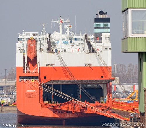
 Tamerlane
Current Status
Where is the vessel?
Tamerlane is currently in Near DUNDALK, based on AIS data received less than 1h ago.
Latest AIS update:
Current position: 39.24399° N, 76.53760° W (Near DUNDALK)
Average speed (last 7 days): Loading…
Average speed (last 30 days): Loading…
Vessel profile: Tamerlane is a Vehicles Carrier with dimensions 245m x 32m.
This page combines live AIS, route history, probable destination signals, nearby traffic, and port activity for practical vessel monitoring.
The current position of vessel Tamerlane is 39.24399 lat / -76.53760 lng. Updated: 2026-05-14 23:31:17 UTCNearest reference points:
- Near DUNDALK
- Near Baltimore
- Near Curtis Bay, Baltimore
Currently sailing under the flag of Norway ![]()
Tamerlane built in 2001 year
Deadweight:
38500 tDetails:
Live Vessel Tamerlane Analytics (details, animations, etc.)
Recent AIS points (UTC):
2026-05-14 19:47:18 UTC · 39.25055, -76.58069 · SOG 0 kn · COG 32°2026-05-14 21:46:13 UTC · 39.24398, -76.53760 · SOG 0 kn · COG 324°
2026-05-14 23:10:15 UTC · 39.24399, -76.53762 · SOG 0 kn · COG 324°
2026-05-14 23:31:17 UTC · 39.24399, -76.53760 · SOG 0 kn · COG 324°