 vesseltracker.com
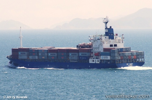
 St. Mary
Current Status
Where is the vessel?
St. Mary is currently in 115 nm NE of Port Blair, based on AIS data received less than 1h ago.
Latest AIS update:
Current position: 12.78833° N, 94.34500° E (115 nm NE of Port Blair)
Average speed (last 7 days): Loading…
Average speed (last 30 days): Loading…
Vessel profile: St. Mary is a Container Ship with dimensions 168m x 27m.
This page combines live AIS, route history, probable destination signals, nearby traffic, and port activity for practical vessel monitoring.
The current position of vessel St. Mary is 12.78833 lat / 94.34500 lng. Updated: 2026-05-13 23:18:04 UTCNearest reference points:
- 84 nm NW of Yetagun Field
- Near Port Blair
- 126 nm S of Yetagun Field
Currently sailing under the flag of Cyprus ![]()
St. Mary built in 2001 year
Deadweight:
21579 tDetails:
Live Vessel St. Mary Analytics (details, animations, etc.)
Recent AIS points (UTC):
2026-05-13 20:15:01 UTC · 13.36500, 94.04833 · SOG 12 kn · COG -1°2026-05-13 22:00:05 UTC · 13.03167, 94.21500 · SOG 12 kn · COG -1°
2026-05-13 22:45:03 UTC · 12.89167, 94.29167 · SOG 12 kn · COG -1°
2026-05-13 23:18:04 UTC · 12.78833, 94.34500 · SOG 12 kn · COG -1°