 vesseltracker.com
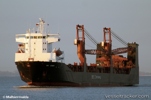
 LADY MARIIA
Current Status
Where is the vessel?
LADY MARIIA is currently in 120 nm W of Salomague, based on AIS data received less than 1h ago.
Latest AIS update:
Current position: 18.28833° N, 118.38167° E (120 nm W of Salomague)
Average speed (last 7 days): Loading…
Average speed (last 30 days): Loading…
Vessel profile: LADY MARIIA is a Ro-Ro Cargo with dimensions 126.88m x 20m.
This page combines live AIS, route history, probable destination signals, nearby traffic, and port activity for practical vessel monitoring.
The current position of vessel LADY MARIIA is 18.28833 lat / 118.38167 lng. Updated: 2026-05-14 22:24:49 UTCNearest reference points:
- 138 nm NW of Bolinao
- 22 nm W of Salomague
- 148 nm SE of Xijiang
Currently sailing under the flag of Russia ![]()
LADY MARIIA built in 2000 year
Deadweight:
7184 tDetails:
Live Vessel LADY MARIIA Analytics (details, animations, etc.)
Recent AIS points (UTC):
2026-05-14 19:15:49 UTC · 18.65333, 118.74833 · SOG 9 kn · COG -1°2026-05-14 20:12:51 UTC · 18.54167, 118.63667 · SOG 9 kn · COG -1°
2026-05-14 22:06:48 UTC · 18.32333, 118.41667 · SOG 9 kn · COG -1°
2026-05-14 22:24:49 UTC · 18.28833, 118.38167 · SOG 9 kn · COG -1°