 vesseltracker.com
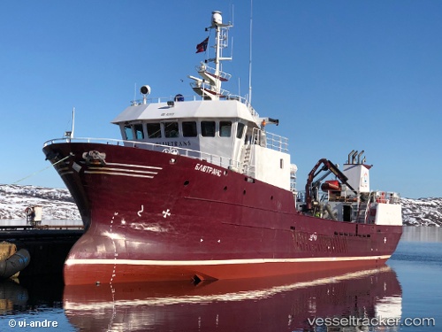
 Bluetrans
Current Status
Where is the vessel?
Bluetrans is currently in Near Murmansk, based on AIS data received about 2d ago.
Latest AIS update:
Current position: 68.94500° N, 33.00803° E (Near Murmansk)
Average speed (last 7 days): Loading…
Average speed (last 30 days): Loading…
Vessel profile: Bluetrans is a Fish Carrier with dimensions 40m x 9m.
This page combines live AIS, route history, probable destination signals, nearby traffic, and port activity for practical vessel monitoring.
The current position of vessel Bluetrans is 68.94500 lat / 33.00803 lng. Updated: 2026-04-21 13:35:31 UTCNearest reference points:
- Near Murmansk
- Near Ura-Guba
- 12 nm NE of Ura-Guba
Currently sailing under the flag of Russia ![]()
Bluetrans built in 2000 year
Deadweight:
300 tDetails:
Live Vessel Bluetrans Analytics (details, animations, etc.)
Recent AIS points (UTC):
2026-04-21 13:35:31 UTC · 68.94500, 33.00803 · SOG 5.1 kn · COG 239°2026-04-21 13:35:31 UTC · 68.94500, 33.00803 · SOG 5.1 kn · COG 239°
2026-04-21 13:35:31 UTC · 68.94500, 33.00803 · SOG 5.1 kn · COG 239°
2026-04-21 13:35:31 UTC · 68.94500, 33.00803 · SOG 5.1 kn · COG 239°