 vesseltracker.com
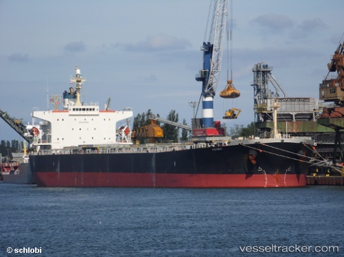
 ARCTURUS I
Current Status
Where is the vessel?
ARCTURUS I is currently in Near Lianyungang, based on AIS data received less than 1h ago.
Latest AIS update:
Current position: 34.74976° N, 119.40158° E (Near Lianyungang)
Average speed (last 7 days): Loading…
Average speed (last 30 days): Loading…
Vessel profile: ARCTURUS I is a Bulk Carrier with dimensions m x m.
This page combines live AIS, route history, probable destination signals, nearby traffic, and port activity for practical vessel monitoring.
The current position of vessel ARCTURUS I is 34.74976 lat / 119.40158 lng. Updated: 2026-04-27 21:40:19 UTCNearest reference points:
- Near Lianyungang
- 12 nm SE of Lianyungang
- Near Lanshan Pt
Currently sailing under the flag of Marshall Islands ![]()
Details:
Live Vessel ARCTURUS I Analytics (details, animations, etc.)
Recent AIS points (UTC):
2026-04-27 18:23:16 UTC · 34.75174, 119.40673 · SOG 4.3 kn · COG 251°2026-04-27 19:46:19 UTC · 34.74977, 119.40158 · SOG 0 kn · COG 271°
2026-04-27 20:22:18 UTC · 34.74977, 119.40158 · SOG 0 kn · COG 271°
2026-04-27 21:40:19 UTC · 34.74976, 119.40158 · SOG 0 kn · COG 271°