 vesseltracker.com
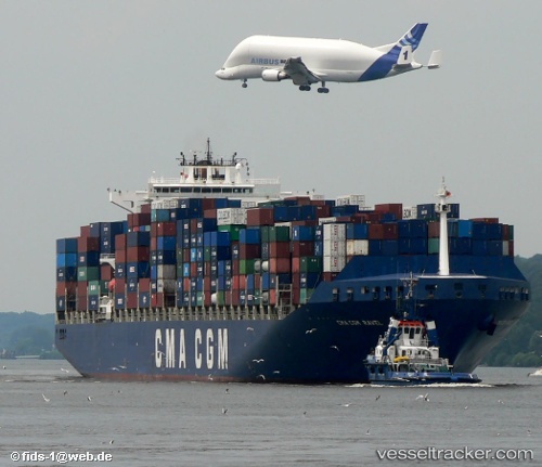
 PORTO CHELI
Current Status
Where is the vessel?
PORTO CHELI is currently in 105 nm SE of NANTUCKET, based on AIS data received less than 1h ago.
Latest AIS update:
Current position: 39.94118° N, 68.60510° W (105 nm SE of NANTUCKET)
Average speed (last 7 days): Loading…
Average speed (last 30 days): Loading…
Vessel profile: PORTO CHELI is a Container Ship with dimensions 40m x 300m.
This page combines live AIS, route history, probable destination signals, nearby traffic, and port activity for practical vessel monitoring.
The current position of vessel PORTO CHELI is 39.94118 lat / -68.60510 lng. Updated: 2026-05-15 13:32:24 UTCNearest reference points:
- 28 nm SE of East Harwich
- 126 nm SE of Offshore Ambrose
- 114 nm SE of Offshore Ambrose
Currently sailing under the flag of Liberia ![]()
PORTO CHELI built in 2001 year
Deadweight:
79465 tDetails:
Live Vessel PORTO CHELI Analytics (details, animations, etc.)
Recent AIS points (UTC):
2026-05-15 09:50:28 UTC · 39.90937, -67.25579 · SOG 16.7 kn · COG 270°2026-05-15 09:58:21 UTC · 39.91036, -67.30330 · SOG 16.6 kn · COG 270°
2026-05-15 11:45:37 UTC · 39.92820, -67.94368 · SOG 16.8 kn · COG 271°
2026-05-15 13:32:24 UTC · 39.94118, -68.60510 · SOG 17.3 kn · COG 273°