 vesseltracker.com
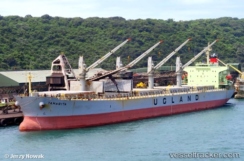
 Pacific Tamarita
Current Status
Where is the vessel?
Pacific Tamarita is currently in Near Davao, based on AIS data received less than 1h ago.
Latest AIS update:
Current position: 6.92967° N, 125.61735° E (Near Davao)
Average speed (last 7 days): Loading…
Average speed (last 30 days): Loading…
Vessel profile: Pacific Tamarita is a Bulk Carrier with dimensions 190m x 32m.
This page combines live AIS, route history, probable destination signals, nearby traffic, and port activity for practical vessel monitoring.
The current position of vessel Pacific Tamarita is 6.92967 lat / 125.61735 lng. Updated: 2026-04-23 10:14:30 UTCNearest reference points:
- Near DICT / SVT
- 48 nm N of Melonguanne
- 17 nm SW of Bacong
Currently sailing under the flag of Panama ![]()
Pacific Tamarita built in 2001 year
Deadweight:
52292 tDetails:
Live Vessel Pacific Tamarita Analytics (details, animations, etc.)
Recent AIS points (UTC):
2026-04-23 07:26:43 UTC · 6.37167, 125.76167 · SOG 12 kn · COG -1°2026-04-23 07:59:40 UTC · 6.48667, 125.74333 · SOG 12 kn · COG -1°
2026-04-23 10:00:31 UTC · 6.89565, 125.64911 · SOG 11.8 kn · COG 320°
2026-04-23 10:14:30 UTC · 6.92967, 125.61735 · SOG 11.8 kn · COG 349°