 vesseltracker.com
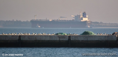
 GRUS I
Current Status
Where is the vessel?
GRUS I is currently in Near TANAH MERAH, based on AIS data received less than 1h ago.
Latest AIS update:
Current position: 1.27568° N, 104.00016° E (Near TANAH MERAH)
Average speed (last 7 days): Loading…
Average speed (last 30 days): Loading…
Vessel profile: GRUS I is a Crude Oil Tanker with dimensions m x m.
This page combines live AIS, route history, probable destination signals, nearby traffic, and port activity for practical vessel monitoring.
The current position of vessel GRUS I is 1.27568 lat / 104.00016 lng. Updated: 2026-05-14 10:43:00 UTCNearest reference points:
- Near Changi
- Near TANAH MERAH
- Near Tampines
Currently sailing under the flag of Cameroon ![]()
Details:
Live Vessel GRUS I Analytics (details, animations, etc.)
Recent AIS points (UTC):
2026-05-14 07:45:54 UTC · 1.23850, 103.95090 · SOG 5.2 kn · COG 3°2026-05-14 07:56:34 UTC · 1.25067, 103.94868 · SOG 3.4 kn · COG 347°
2026-05-14 09:22:24 UTC · 1.27540, 104.00128 · SOG 1.7 kn · COG 80°
2026-05-14 10:43:00 UTC · 1.27568, 104.00016 · SOG 0 kn · COG 91°