 vesseltracker.com
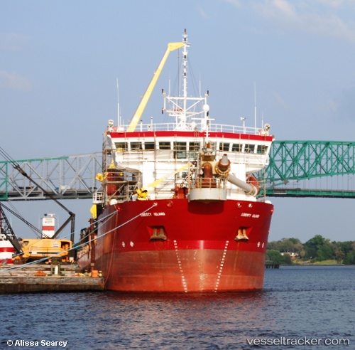
Liberty Island
Current StatusWhere is the vessel?
Liberty Island is currently in Near Norfolk, based on AIS data received less than 1h ago.
Latest AIS update:
Current position: 36.83714° N, 76.26595° W (Near Norfolk)
Average speed (last 7 days): Loading…
Average speed (last 30 days): Loading…
Vessel profile: Liberty Island is a Hopper Dredger with dimensions 18m x 99m.
This page combines live AIS, route history, probable destination signals, nearby traffic, and port activity for practical vessel monitoring.
The current position of vessel Liberty Island is 36.83714 lat / -76.26595 lng. Updated: 2026-05-14 14:15:17 UTCNearest reference points:
- Near Norfolk
- Near Fentress
- Near Little Creek
Details:
Live Vessel Liberty Island Analytics (details, animations, etc.)
Recent AIS points (UTC):
2026-05-14 10:30:34 UTC · 36.83667, -76.26500 · SOG 0 kn · COG -1°2026-05-14 11:27:22 UTC · 36.83712, -76.26597 · SOG 0 kn · COG 170°
2026-05-14 13:36:27 UTC · 36.83712, -76.26595 · SOG 0 kn · COG 170°
2026-05-14 14:15:17 UTC · 36.83714, -76.26595 · SOG 0 kn · COG 170°