 vesseltracker.com
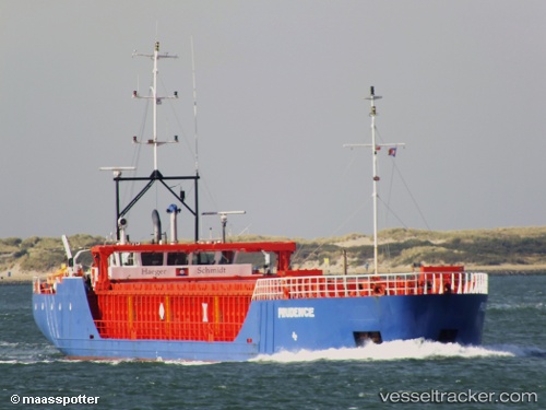
 ALLORA
Current Status
Where is the vessel?
ALLORA is currently in 29 nm NW of Bénouville, based on AIS data received less than 1h ago.
Latest AIS update:
Current position: 50.13773° N, 0.13406° W (29 nm NW of Bénouville)
Average speed (last 7 days): Loading…
Average speed (last 30 days): Loading…
Vessel profile: ALLORA is a General Cargo with dimensions m x m.
This page combines live AIS, route history, probable destination signals, nearby traffic, and port activity for practical vessel monitoring.
The current position of vessel ALLORA is 50.13773 lat / -0.13406 lng. Updated: 2026-05-14 22:24:13 UTCNearest reference points:
- 27 nm S of Seaford
- 23 nm S of Ferring
- Near Le Havre
Currently sailing under the flag of Antigua and Barbuda ![]()
Details:
Live Vessel ALLORA Analytics (details, animations, etc.)
Recent AIS points (UTC):
2026-05-14 16:17:54 UTC · 50.73409, 0.75762 · SOG 11.4 kn · COG 234°2026-05-14 17:25:53 UTC · 50.62617, 0.50472 · SOG 9.6 kn · COG 243°
2026-05-14 19:51:33 UTC · 50.47490, 0.03696 · SOG 8.2 kn · COG 244°
2026-05-14 22:24:13 UTC · 50.13773, -0.13406 · SOG 8 kn · COG 186°