 vesseltracker.com
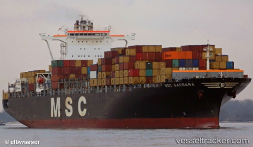
 Msc Barbara
Current Status
Where is the vessel?
Msc Barbara is currently in Near Onne, based on AIS data received about 1h ago.
Latest AIS update:
Current position: 4.67082° N, 7.15357° E (Near Onne)
Average speed (last 7 days): Loading…
Average speed (last 30 days): Loading…
Vessel profile: Msc Barbara is a Container Ship with dimensions 304m x 304m.
This page combines live AIS, route history, probable destination signals, nearby traffic, and port activity for practical vessel monitoring.
The current position of vessel Msc Barbara is 4.67082 lat / 7.15357 lng. Updated: 2026-05-14 05:41:32 UTCNearest reference points:
- Near Onne
- Near Port Harcourt
- Near Bonny
Currently sailing under the flag of Panama ![]()
Msc Barbara built in 2002 year
Deadweight:
85820 tDetails:
Live Vessel Msc Barbara Analytics (details, animations, etc.)
Recent AIS points (UTC):
2026-05-14 01:26:40 UTC · 4.67081, 7.15356 · SOG 0 kn · COG 10°2026-05-14 03:41:39 UTC · 4.67080, 7.15358 · SOG 0 kn · COG 11°
2026-05-14 04:32:35 UTC · 4.67082, 7.15357 · SOG 0 kn · COG 10°
2026-05-14 05:41:32 UTC · 4.67082, 7.15357 · SOG 0 kn · COG 10°