 vesseltracker.com
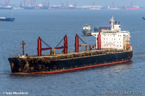
 M V. Artaria
Current Status
Where is the vessel?
M V. Artaria is currently in Near Bandar Abbas, based on AIS data received less than 1h ago.
Latest AIS update:
Current position: 27.06500° N, 56.32500° E (Near Bandar Abbas)
Average speed (last 7 days): Loading…
Average speed (last 30 days): Loading…
Vessel profile: M V. Artaria is a Bulk Carrier with dimensions 225m x 33m.
This page combines live AIS, route history, probable destination signals, nearby traffic, and port activity for practical vessel monitoring.
The current position of vessel M V. Artaria is 27.06500 lat / 56.32500 lng. Updated: 2026-05-13 23:41:13 UTCNearest reference points:
- Near QUESHM
- Near LARAK
- Near SHAHID BAHONAR
Currently sailing under the flag of Iran ![]()
M V. Artaria built in 2001 year
Deadweight:
72162 tDetails:
Live Vessel M V. Artaria Analytics (details, animations, etc.)
Recent AIS points (UTC):
2026-05-13 19:49:29 UTC · 27.06500, 56.32500 · SOG 0 kn · COG -1°2026-05-13 22:04:56 UTC · 27.06500, 56.32500 · SOG 2 kn · COG -1°
2026-05-13 22:29:02 UTC · 27.06500, 56.32500 · SOG 0 kn · COG -1°
2026-05-13 23:41:13 UTC · 27.06500, 56.32500 · SOG 0 kn · COG -1°