 vesseltracker.com
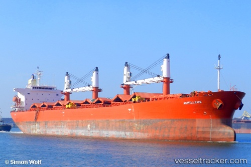
 ACRUX
ACRUX
Current Status
Where is the vessel?
ACRUX is currently in Near Mumbai, based on AIS data received less than 1h ago.
Latest AIS update:
Current position: 18.93571° N, 72.84385° E (Near Mumbai)
Average speed (last 7 days): Loading…
Average speed (last 30 days): Loading…
Vessel profile: ACRUX is a Bulk Carrier with dimensions 190m x 190m.
This page combines live AIS, route history, probable destination signals, nearby traffic, and port activity for practical vessel monitoring.
The current position of vessel ACRUX is 18.93571 lat / 72.84385 lng. Updated: 2026-04-24 12:27:35 UTCNearest reference points:
- Near Mumbai
- Near HNB SEZ/Mumbai
- Near NHAVA SHEVA
Currently sailing under the flag of Panama ![]()
ACRUX built in 2001 year
Deadweight:
50992 tDetails:
Live Vessel ACRUX Analytics (details, animations, etc.)
Recent AIS points (UTC):
2026-04-24 07:53:58 UTC · 18.93563, 72.84391 · SOG 0 kn · COG 11°2026-04-24 10:08:55 UTC · 18.93565, 72.84395 · SOG 0 kn · COG 11°
2026-04-24 10:27:26 UTC · 18.93575, 72.84394 · SOG 0 kn · COG 11°
2026-04-24 12:27:35 UTC · 18.93571, 72.84385 · SOG 0 kn · COG 11°