 vesseltracker.com
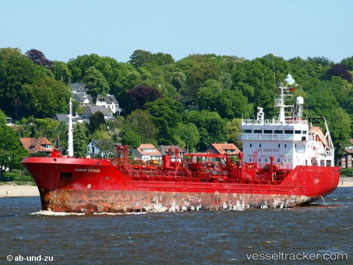
 TOMRIS E
Current Status
Where is the vessel?
TOMRIS E is currently in Near Küçükçekmece, based on AIS data received about 1h ago.
Latest AIS update:
Current position: 40.95871° N, 28.75760° E (Near Küçükçekmece)
Average speed (last 7 days): Loading…
Average speed (last 30 days): Loading…
Vessel profile: TOMRIS E is a Chemical/Oil Products Tanker with dimensions 92m x 14m.
This page combines live AIS, route history, probable destination signals, nearby traffic, and port activity for practical vessel monitoring.
The current position of vessel TOMRIS E is 40.95871 lat / 28.75760 lng. Updated: 2026-03-30 17:47:12 UTCNearest reference points:
- Near Kumport
- Near Küçükçekmece
- Near Ambarli
Currently sailing under the flag of Turkey ![]()
TOMRIS E built in 2001 year
Deadweight:
4454 tDetails:
Live Vessel TOMRIS E Analytics (details, animations, etc.)
Recent AIS points (UTC):
2026-03-30 11:59:20 UTC · 40.95839, 28.75975 · SOG 0.2 kn · COG 235°2026-03-30 14:00:47 UTC · 40.95863, 28.75950 · SOG 0.1 kn · COG 210°
2026-03-30 15:41:14 UTC · 40.95865, 28.75788 · SOG 0.2 kn · COG 157°
2026-03-30 17:47:12 UTC · 40.95871, 28.75760 · SOG 0.1 kn · COG 142°