 vesseltracker.com
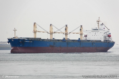
 Lady Mary
Current Status
Where is the vessel?
Lady Mary is currently in Near LANSHAN, based on AIS data received less than 1h ago.
Latest AIS update:
Current position: 35.06745° N, 119.59181° E (Near LANSHAN)
Average speed (last 7 days): Loading…
Average speed (last 30 days): Loading…
Vessel profile: Lady Mary is a Bulk Carrier with dimensions 190m x 32m.
This page combines live AIS, route history, probable destination signals, nearby traffic, and port activity for practical vessel monitoring.
The current position of vessel Lady Mary is 35.06745 lat / 119.59181 lng. Updated: 2026-05-16 07:50:27 UTCNearest reference points:
- Near LANSHAN
- 11 nm SE of Rizhao
- Near Rizhao
Currently sailing under the flag of Panama ![]()
Lady Mary built in 2001 year
Deadweight:
52027 tDetails:
Live Vessel Lady Mary Analytics (details, animations, etc.)
Recent AIS points (UTC):
2026-05-16 04:44:27 UTC · 35.06891, 119.59229 · SOG 0 kn · COG 122°2026-05-16 06:05:15 UTC · 35.06827, 119.59181 · SOG 0.1 kn · COG 104°
2026-05-16 07:47:26 UTC · 35.06748, 119.59167 · SOG 0 kn · COG 82°
2026-05-16 07:50:27 UTC · 35.06745, 119.59181 · SOG 0.3 kn · COG 89°