 vesseltracker.com
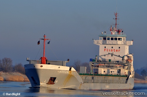
 KAILEEN
Current Status
Where is the vessel?
KAILEEN is currently in 20 nm E of Färjestaden, based on AIS data received less than 1h ago.
Latest AIS update:
Current position: 56.56469° N, 17.02650° E (20 nm E of Färjestaden)
Average speed (last 7 days): Loading…
Average speed (last 30 days): Loading…
Vessel profile: KAILEEN is a General Cargo Ship with dimensions 112m x 15m.
This page combines live AIS, route history, probable destination signals, nearby traffic, and port activity for practical vessel monitoring.
The current position of vessel KAILEEN is 56.56469 lat / 17.02650 lng. Updated: 2026-05-14 07:59:56 UTCNearest reference points:
- Near Karlskrona
- 31 nm NW of Ustka
- Near RONNEBY
Currently sailing under the flag of Antigua and Barbuda ![]()
KAILEEN built in 2001 year
Deadweight:
6358 tDetails:
Live Vessel KAILEEN Analytics (details, animations, etc.)
Recent AIS points (UTC):
2026-05-14 03:43:18 UTC · 57.25960, 17.52760 · SOG 10.5 kn · COG 202°2026-05-14 04:34:47 UTC · 57.11928, 17.42724 · SOG 10.6 kn · COG 202°
2026-05-14 05:45:47 UTC · 56.92812, 17.28243 · SOG 10.5 kn · COG 201°
2026-05-14 07:59:56 UTC · 56.56469, 17.02650 · SOG 10.7 kn · COG 202°