 vesseltracker.com
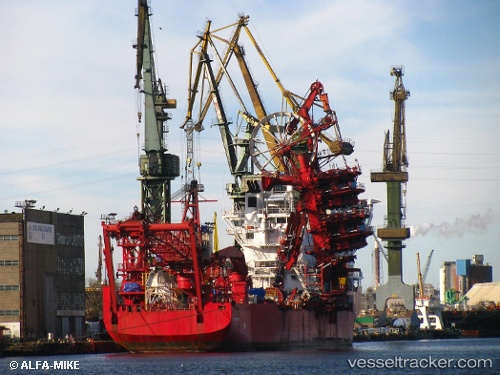
 ILE DYEU
Current Status
Where is the vessel?
ILE DYEU is currently in 396 nm S of Harper, based on AIS data received less than 1h ago.
Latest AIS update:
Current position: 2.12167° S, 8.89833° W (396 nm S of Harper)
Average speed (last 7 days): Loading…
Average speed (last 30 days): Loading…
Vessel profile: ILE DYEU is a Pipe-Layer with dimensions 27m x 144m.
This page combines live AIS, route history, probable destination signals, nearby traffic, and port activity for practical vessel monitoring.
The current position of vessel ILE DYEU is -2.12167 lat / -8.89833 lng. Updated: 2026-05-16 13:28:36 UTCNearest reference points:
- Open sea, approx. 402 nm off the nearest listed port
- Open sea, approx. 403 nm off the nearest listed port
- Open sea, approx. 404 nm off the nearest listed port
Currently sailing under the flag of France (RIF) ![]()
ILE DYEU built in 2001 year
Deadweight:
13129 tDetails:
Live Vessel ILE DYEU Analytics (details, animations, etc.)
Recent AIS points (UTC):
2026-05-16 10:07:34 UTC · -2.59500, -8.53667 · SOG 10 kn · COG -1°2026-05-16 12:06:24 UTC · -2.31819, -8.74855 · SOG 10.5 kn · COG 325°
2026-05-16 13:10:35 UTC · -2.16333, -8.86667 · SOG 10 kn · COG -1°
2026-05-16 13:28:36 UTC · -2.12167, -8.89833 · SOG 10 kn · COG -1°