 vesseltracker.com
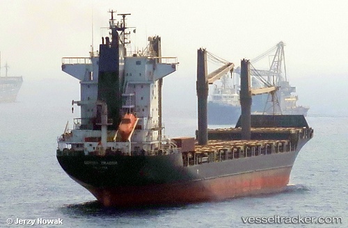
 MSC TRADER II
Current Status
Where is the vessel?
MSC TRADER II is currently in 15 nm SE of Cape St. Jacques, based on AIS data received less than 1h ago.
Latest AIS update:
Current position: 10.15942° N, 107.23942° E (15 nm SE of Cape St. Jacques)
Average speed (last 7 days): Loading…
Average speed (last 30 days): Loading…
Vessel profile: MSC TRADER II is a Container Ship with dimensions 168m x 168m.
This page combines live AIS, route history, probable destination signals, nearby traffic, and port activity for practical vessel monitoring.
The current position of vessel MSC TRADER II is 10.15942 lat / 107.23942 lng. Updated: 2026-05-13 19:18:25 UTCNearest reference points:
- 11 nm SE of Cape St. Jacques
- 12 nm SE of Cape St. Jacques
- Near Cape St. Jacques
Currently sailing under the flag of Liberia ![]()
MSC TRADER II built in 2001 year
Deadweight:
22968 tDetails:
Live Vessel MSC TRADER II Analytics (details, animations, etc.)
Recent AIS points (UTC):
2026-05-13 16:00:25 UTC · 10.15945, 107.23709 · SOG 0 kn · COG 138°2026-05-13 16:09:25 UTC · 10.15958, 107.23715 · SOG 0 kn · COG 141°
2026-05-13 17:36:25 UTC · 10.15992, 107.23836 · SOG 0 kn · COG 197°
2026-05-13 19:18:25 UTC · 10.15942, 107.23942 · SOG 0 kn · COG 236°