 vesseltracker.com
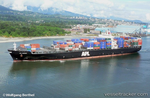
 GSL MARIA
Current Status
Where is the vessel?
GSL MARIA is currently in 82 nm NW of Chapineria, based on AIS data received less than 1h ago.
Latest AIS update:
Current position: 41.60108° N, 42.14979° W (82 nm NW of Chapineria)
Average speed (last 7 days): Loading…
Average speed (last 30 days): Loading…
Vessel profile: GSL MARIA is a Container Ship with dimensions 276m x 40m.
This page combines live AIS, route history, probable destination signals, nearby traffic, and port activity for practical vessel monitoring.
The current position of vessel GSL MARIA is 41.60108 lat / -42.14979 lng. Updated: 2026-05-16 07:38:45 UTCCurrently sailing under the flag of Liberia ![]()
GSL MARIA built in 2001 year
Deadweight:
68025 tDetails:
Live Vessel GSL MARIA Analytics (details, animations, etc.)
Recent AIS points (UTC):
2026-05-16 03:59:27 UTC · 41.57563, -43.38915 · SOG 14.8 kn · COG 93°2026-05-16 04:39:24 UTC · 41.58067, -43.16793 · SOG 15.1 kn · COG 93°
2026-05-16 06:14:51 UTC · 41.58850, -42.62799 · SOG 15.4 kn · COG 91°
2026-05-16 07:38:45 UTC · 41.60108, -42.14979 · SOG 15.6 kn · COG 88°