 vesseltracker.com
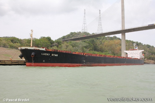
Lucky Star
Current StatusWhere is the vessel?
Lucky Star is currently in Near HUANGPU, based on AIS data received less than 1h ago.
Latest AIS update:
Current position: 23.05728° N, 113.50372° E (Near HUANGPU)
Average speed (last 7 days): Loading…
Average speed (last 30 days): Loading…
Vessel profile: Lucky Star is a Bulk Carrier with dimensions 32m x 225m.
This page combines live AIS, route history, probable destination signals, nearby traffic, and port activity for practical vessel monitoring.
The current position of vessel Lucky Star is 23.05728 lat / 113.50372 lng. Updated: 2026-05-15 23:34:29 UTCNearest reference points:
- Near Huangpu New Port
- Near MCID - Private Terminal
- Near Shilou
Details:
Live Vessel Lucky Star Analytics (details, animations, etc.)
Recent AIS points (UTC):
2026-05-15 19:22:18 UTC · 23.05725, 113.50371 · SOG 0 kn · COG 312°2026-05-15 21:55:23 UTC · 23.05725, 113.50369 · SOG 0 kn · COG 312°
2026-05-15 22:58:25 UTC · 23.05726, 113.50366 · SOG 0 kn · COG 312°
2026-05-15 23:34:29 UTC · 23.05728, 113.50372 · SOG 0 kn · COG 312°