 vesseltracker.com
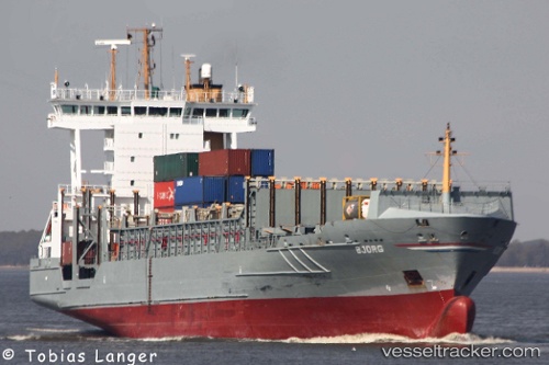
 Bjorg
Bjorg
Current Status
Where is the vessel?
Bjorg is currently in Near Altenwerder, based on AIS data received about 1h ago.
Latest AIS update:
Current position: 53.53179° N, 9.90950° E (Near Altenwerder)
Average speed (last 7 days): Loading…
Average speed (last 30 days): Loading…
Vessel profile: Bjorg is a Container Ship with dimensions 133m x 22m.
This page combines live AIS, route history, probable destination signals, nearby traffic, and port activity for practical vessel monitoring.
The current position of vessel Bjorg is 53.53179 lat / 9.90950 lng. Updated: 2026-05-13 17:23:36 UTCNearest reference points:
- Near Bahrenfeld
- Near Hamburg-Mitte
- Near Allermöhe
Currently sailing under the flag of Antigua Barbuda ![]()
Bjorg built in 2001 year
Deadweight:
11386 tDetails:
Live Vessel Bjorg Analytics (details, animations, etc.)
Recent AIS points (UTC):
2026-05-13 14:23:35 UTC · 53.55464, 9.80129 · SOG 9.3 kn · COG 108°2026-05-13 15:35:34 UTC · 53.53179, 9.90949 · SOG 0 kn · COG 306°
2026-05-13 16:32:37 UTC · 53.53179, 9.90950 · SOG 0 kn · COG 306°
2026-05-13 17:23:36 UTC · 53.53179, 9.90950 · SOG 0 kn · COG 306°